
Walk to enjoy your campus and your health...
The University of Minnesota Crookston has a few walking routes for you to try. They've been calculated and range from about a quarter of a mile (green line), to .3 of a mile (yellow line) all the way to a little over a mile (red line)... so take the best route for you!
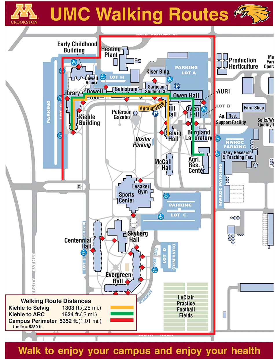
Crookston Campus Walking Route Map (Printable PDF)
| Walking Route | Distance | Buildings/Campus Area Path |
|---|---|---|
| Kiehle to Selvig (Yellow Line) | 1303 ft. (.25 mile) | |
| Kiehle to ARC (Green Line) | 1624 ft. (.3 mile) | |
| Campus Perimeter (Red Line) | 5352 ft. (1.01 mile) |
|